

TerraGo Edge app for iPhone and iPad
Developer: TerraGo
First release : 19 Jul 2014
App size: 117.13 Mb
TerraGo Edge is a mobile forms and GPS data collection solution that makes it easy for companies to create, share and complete custom forms for inspections, surveys, work orders, site audits, field service calls, invoices, timesheets and all types of mobile workforce applications for any industry. With seamless integration to GIS platforms, CAD systems and survey-grade GPS receivers, even the most demanding engineering and mapping users can take advantage of our modern user interface to increase productivity and eliminate paper forms while accessing schematics, diagrams, maps and imagery from any location.
Key features:
- Custom Smart Forms – companies can build custom forms that ensure data quality and maximize productivity, with advanced features like form groups, conditional fields, barcode and QR code support,.repeating fields and groups, expand/collapse, calculated fields, multiple form attachments and automatic progressive saving of form data.
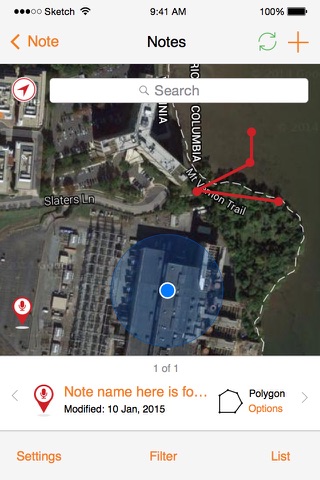
- High Accuracy GPS support – One of the only apps on the market that provides true accuracy reporting from 3rd party GPS devices with full NMEA data.
- Advanced ArcGIS(R), GIS platform integration – Supports GIS data quality management with accuracy settings and multiple methods for GIS data export/import via shapefiles, geodatabase, GeoPackage, CSV, WMS, JSON, REST API and WFS.
- Open – TerraGo Edge Server is designed for ease of data sharing and universal portability, with an open spatial database, zero proprietary formats and support for a growing number of industry formats and interfaces
- Notebooks & Syncing – your notes are automatically synced across all devices for easy collaboration
- Dashboard – monitor field operations in real-time
- Custom Offline Maps – create your own maps that can be accessed even without connectivity
- Online Maps – Access your ArcGIS Online ® or free maps from OpenStreetMaps Mapquest, and more
- Multiple deployment options: Use an on-premise solution server for sensitive data, or take advantage of our cloud hosting for easy setup
- User Locator – View real-time progress of your workers and their tasks*
* User locator, when enabled, utilizes your GPS to report back your location. Continued use of GPS running in the background can dramatically decrease battery life.